A YEAR IN TINTYPE

We know that behind every image revealed there is another image more faithful to reality, and in the back of that image there is another, and yet another behind the last one, and so on, up to the true image of that absolute, mysterious reality that no one will ever see.

-Michelangelo Antonioni

Staunton, VA

OVER the past year I’ve been filtering shots from hiking excursions in North Carolina and Virginia through an iOS app called TinType. TinType re-creates the look of 19th century photographs produced on thin iron plates coated with light-sensitive emulsion. I’m drawn to the archetypal views many early tintypes depict—forests, pathways, mountaintops, streams—and to the rich vocabulary tintypes express through their curious, often amazing artifacts of light and chemistry, mysterious renderings of focus, and the unpredictable ways these objects age and show signs of how they have been used. I like to imagine these little sheets of metal as a subtle kind of hard disk emblazoned not only with the data of the original exposures, but with the impression of each interaction they have had with their environments and the people who held them in their hands and experienced some type of connection to them since their creation.

Confluence Natural Area

I think I would enjoy creating traditional tintypes, and I tip my hat to photographers honoring early tools and processes by doing that in beautiful ways. Over the past year, however, I’ve enjoyed the ready access I’ve had to my camera to record my experiences, as well as the ability to take a lot of pictures to select from later. In the early days photographers had to haul heavy equipment miles along a trail or up a mountain to capture the landscapes to which I’m drawn. And they could usually only expose a handful of plates at a time. There’s a freedom in releasing that apparatus, and a satisfaction in being able to align the taking of a picture with the moment that inspires its creation. These photographs, unlike traditional tintypes could be, are an extension of my perception as I move freely through the world.

Confluence Natural Area

As much as I love the places I photograph, what I most want to explore is how I experience those places. I want to understand the qualities that make the things I observe matter to me. Viewing the present through the vocabulary of tintypes, through the layers of time and process and history they evoke, is a way of approaching that challenge—of taking up the invitation Antonioni extends to explore beyond the surface. What aids my search is that I can never imagine how these images will turn out—and that is part of the fascination they hold for me. In making their source something beyond my expertise, I get to experience the results more as surprises, discoveries, gifts, than a product of what I already know. And that is how I want to encounter the world.

Duke Forest

Imagine a single thought that encompasses, illumines, and lifts to its natural repose everything you’ve ever experienced in your life. Now imagine progressing to that thought through a series of images. The first one stands for ten, the next for a hundred, the next for a thousand. Each one resonates more powerfully and authentically in your heart and in your mind than the last. This is a journey I think I’ll be making my whole life. I’m glad to be able to document a part of that journey here.

—Todd Stabley, June, 2019

Confluence Natural Area

Homeless Man

9035978557_0e261ce74d_k

Homeless man,
standing on the overpass I cross on my way to work,
not facing the expected way–
toward the cars driving next to you–
but instead saluting the souls
swooping under the bridge below,
I see you lifting your arms into the sky,
dancing,
holding a teddy bear in one hand.
I see the morning sunlight streaming onto your face,
and feel the crisp air holding your rapture
in its tight frame.
I have no idea what strange visions give rise to your gesticulations,
but in this moment I simply say yes,
and accept the gift you came to this, of all places, to give.

THE GRANDEUR OF ITS SPREADING LIMBS

33870982310_e617911fe3_o

I called the Calvin Street Oak “my tree” because it was in my front yard, and because I knew and loved it during the five and a half years I was privileged to live under its beautiful canopy. But it was everyone’s tree. One of my favorite things was sitting on my front porch and watching people walk by. Of course they would look up and marvel. How could you not? It was a huge, magnificent, ancient tree. It’s trunk was 27 feet around. It threw off your sense of scale and reminded you what it was like to be a child when everything in the world was big. And after looking up they would look over at me, visibly transformed by their encounter, and we would share in a neighborly conversation invested with an unusually high quotient of wonder. I will miss those conversations, and I will miss this tree like I would a friend.

44054238534_69d2e68d6c_o.jpg

You could say that Hurricane Florence brought it down, but that really wasn’t how it happened. This oak tree chose when and how to leave the spot it had called home since the 1700’s. The light gusts that started on Friday morning when Florence touched the Triangle—ones I barely noticed on my way to yoga class that morning—were part of a conversation between the tree and the wind, the answer to a request for assistance. Thank you, my friend, for waiting until after I left. It would have been hard for me to see and hear you go. Thank you for falling away from the house, for falling so gently that you didn’t even knock over the rock cairn Rachel had just built right next to you. Thank you for not hurting anyone. Thank you for leaving on your terms. For leaving with the same dignity with which you lived your long and mysterious life.

44054277494_2f1dfcf209_o (1).jpg

Before there was an old oak there was a mature oak. Before there was a mature oak there was a young oak. Before the young oak was an acorn. And before the acorn there was energy as potential, an idea of something that could be.

44054277484_cc9e4f3606_o (2).jpg

What would it be like to exist in the same place for two and a half centuries? To cultivate a perspective and a patient watchfulness under which a whole town, a whole country could grow up around you? To support untold beings of countless species as they are born, grow up, live and die or move on? What would it be like to aspire upward from a trunk 27 feet around, lifting branches themselves the size of mature trees high up into the sky? What would it be like to know the subtlety of half a million leaves tuned to infinitesimal gradations of light and wind? I’ve been all over this state hiking, and each time I returned I would marvel that although I saw many amazing trees on my adventures, the most magnificent one of all was right in my front yard.

29828855437_71e00ccb0d_o

I was always curious how tall you were. The Hillsborough Treasure Tree website, which singled you out for the grandeur of your large spreading limbs, said you were “at least 70 feet.” That estimate always seemed overly cautious to me. So after the workers removed your trunk and main limbs, but before the smaller branches had been taken away, I found myself in the field across the street, in the spot where your top-most branches had fell. I pointed myself toward where your trunk had been and began to walk, one foot in front of the other, heel to toe, balancing like a tight-rope walker until I found myself looking upward into the sky in a spot where, if you had still been there, I could have leaned in and pressed myself against you. 111 steps. I went inside and measured my left foot. 11 inches. I measured my right foot. Exactly 11 inches. That comes out to 101.75 feet.

53A1C885-5831-43F6-8063-E0E62187C4E6

Now the place where you stood is strikingly empty. Now there is pure potential once again where once there was the fullness of all things oak tree. Now there is a certain set of inclinations, a certain bent of curiosity, that wouldn’t have been possible before all that you were had been seen, felt, experienced, known. A quantum wire somewhere in the universe is vibrating. The energy in the ether is palpable. There’s the smell of ozone in the air like after a storm. And I can’t wait to see what you choose to become next.

44715197242_ba85b50bcf_o (1).jpg

THE WALL

HipstamaticPhoto-531680009.251065.jpgONCE UPON A TIME, this rock foundation, set by a stream, was an idea in someone’s mind. Someone who needed to build a mill. There was digging, selecting, and stacking. Now, the mill and all its history are gone, and this collection of rocks is an idea in the mind of Nature, with different processes at work. What human mind can encompass those processes and truly appreciate their scale, scope, and beauty?

HipstamaticPhoto-531679958.781738.jpg

THE SHADOW

NOT TOO MANY HOURS removed from headlights, highways, and pouring rain, today I sat on a fallen tree, feet dangling, gazing down on a stream fattened with translucent blue water. I watched the water break swiftly and purposefully, yet without a sound, through a leaf dam from where it sat still as a pond, creating a long channel of movement along the far side of the stream. Through the trees, gentle light fell on my shoulders and onto the water, where it illumined golden nooks made of submerged leaves, branches, and mud. I studied the surface to distinguish all the activity taking place there: twinkling sunlight, flowing ripples, and dancing shadows of leaves and branches swaying above me.

23467230_10155322649236429_1241475138509767960_o

My eyes rested on another spot where the water was moving past the leaf dam. Here, instead of rushing through, it gurgled over the top like an underground spring, zig-zagging between a series of leaf abutments before escaping to the slower-moving water a couple feet away.

I turned around on the tree and reconfigured myself to face the other direction. About a hundred feet ahead, where stream joins river, there was the sound of rushing water. Another, bigger leaf dam? I saw the shadow of the sturdy tree in front of me. My body formed a triangle, my hands planted behind me on the moss-covered bark, my head a circle on top of a pyramid. I lifted my hands to my nose and inhaled the earthy smell. I moved from side to side to make sure that shadow on the water was me.

To get here, I walked 51 years and two miles along the Eno River. At first the path was asphalt, then gravel, then dirt. Then I veered off the trail through the woods. I had never been to this spot before, but my movement was swift and purposeful, and there was no doubt about the destination once I arrived. On this, one of the most beautiful fall days I can remember, there were lessons here I needed to learn.

THE STRING OF SAPPHIRES

THIS PAST WEEK I went camping in the Bitterroot Mountains of western Montana with my uncle, who recently retired from a career managing forests there and two friends of his who are ranch owners and have known and loved the Bitterroot their whole lives. We hiked up Chaffin Creek Canyon, following the stream to its source, 9000 feet high in the snow-filled peaks. As the journey progressed, I kept finding lessons everywhere: losing the trail but finding it again when you realize you just have to listen for the sound of water. Remembering how important it is to keep focus so you don’t lose your footing and injure yourself or send a loose rock down on your friend. Finding an amazing spot but not settling there because you know there is more beyond.

28048053559_3999a944a5_k
https://kuula.co/post/7PP6k?fs=1&vr=0&thumbs=1&chromeless=0&logo=0

The prize of this hike was a series of mountain lakes called the String of Sapphires because of their shimmering crystal blue hues. Hardly anyone goes there. To get to them you have to scale a nearly thousand-foot cliff where a waterfall cascades over the side, and by this time you are already far up into the canyon and have been enjoying three beautiful lakes that are themselves worthy destinations (and that in our case captivated us for two days and nights before we set our sights beyond). I looked up at what seemed to be the canyon’s rim wondering, where is all that water coming from?

39826413861_f977c88373_k.jpg

Only one way to find out, and once up there you realize there is much, much more than what you saw from below. After a precarious ascent using any bit of rock, tuft of grass or shrub you can find for leverage, you breathe a sigh of relief to find more certain ground. You discover a skinny path to the waterfall behind waist-high snow sheets slowly detaching from the mountain. You get as close to the edge of the falls as your adrenaline allows and take in the view before following the stream up from there through lush, mossy meadows as it meanders from one small lake to the next. The air feels crisp and clean in your nostrils and lungs.

Each lake stair-steps a little higher than the last, and is fed by a charming waterfall you feel you could sit beside for hours. I knew I had to dive into one of those lakes, and I chose the third one, because it was deeper than the others and tantalizingly blue. I could hang out for about a minute in the lakes below, but these waters were fed directly from the snow pack, and I lasted all of about 5 seconds here. Lake #4 is big, and you think it’s the end, but then you notice more water coming over the 300-foot ridge behind it. Tired as you are, you dig a little deeper and continue up. You figure out a way around boulders the size of small houses and traverse large, open slopes of snow, planting your feet heel-first so you don’t go sliding down. There are no real trails here. You reach an open spot at 9000 feet above all but the scrubbiest vegetation. You’re standing on solid granite and quartz, kicking chunks of rock broken off by the freeze-thaw cycle at work for centuries in the crevices and cavities. The wind whipping against your face feels like winter and tries to throw you off balance. You steady yourself. You’re breathing hard but feel exhilaration in the views that go for miles to the left and right. Down in front of you, at last, there it is–the creek’s source. A big, blue alpine lake with no name, surrounded by a round, sloping, snow-filled granite bowl.

Beyond is yet another ridge. It’s the final one. Precipitous and jagged, it’s called “The Shard,” and it looms up another 800 feet, close to another mile away. Nothing grows there, and its stacks of rocks look like a well-placed gust could bring them crashing down. We want to go to its very top, where you can peer over into the next canyon, all the way into Idaho. But we are getting nervous about the time. The afternoon clouds are coming in, and we saw countless lightning-struck trees on the way up. And we could only imagine retracing our path down that cliff in the wet. So we’ll save the final ascent for another day, and in the meantime savor rich memories of amazing sights, great companionship, and an unforgettable adventure.

A GIFT

ON A MAGNIFICENT SUNNY DAY LAST AUGUST, one which epitomized the beauty of summer in the North Carolina mountains, I hiked up one of Mt. Mitchell’s main trails to the summit. I had arrived there several times before by bike and a couple by car, but this was the first time powered by my own two feet. Mt. Mitchell is the crown of the Black Mountains and the highest point east of the Mississippi. With my 50th birthday a couple months away, I found myself magnetically drawn to this place. It was not the first time I would climb that majestic peak this fall.

28356236174_832a59eb50_o (1).jpg

While milling around among the crowds of people who had driven to the top, I spotted a side trail and started following it back down the mountain. As it meandered over the steep, rocky terrain away from the crowds, at some magical point I realized that not one of the beautiful sounds I was hearing was created by a human. I was still under that dense spruce-fir canopy, but this silence was opening up space all around me, and creating a deep feeling of relaxation and peace. Surely this experience had been available to me on the trek up, but I must have been too lost in my thoughts to notice. Sometimes it takes a while for nature to break us open to its beauty. In that moment I realized this peace was exactly what I had been craving all along.

I kept going. Soon I caught the faint, tantalizing sound of running water. Something said, “Go there.” I would have to venture off the trail to find it. And that’s exactly what I was going to do. The sound got louder as I crouched and pushed aside branches. Louder still. Finally, the woods opened, and my ears were filled with the glorious chaos of a majestic crashing waterfall. Soaked with sweat from 10 miles of hard hiking in the summer sun, I looked down and saw my clothes as a burden, the only remaining obstacle between my soul and the perfect alignment with nature I had been closing in on all day. I left them in a pile. I stepped carefully over large rocks, feeling the cold on my feet and the delightful squish of wet moss between my toes. Those rocks had existed for millions of years only to find their way to those exact spots. What similarly mysterious forces smoothed my rough edges and brought me here to notice them in this moment? I felt exhilaration as I slipped into that cold mountain stream.

One day I might try to find my way back to this spot, but I knew without a doubt that this moment was utterly unique in the universe—a gift, designed perfectly for me, and perfectly of this moment. And in that recognition I felt the question arise–what would my next 50 years be like if I listened whenever that voice inside says, quietly but unmistakably, “Go there”?

CONFLUENCE

April 11, 2017

YESTERDAY I RODE MY BIKE through the rolling farmland north of Hillsborough. The temperature was perfect and the lush fields were bathed in the golden light of the late afternoon sun. I found myself headed to a place called the Confluence, where the East and West forks of the Eno River converge and the river builds momentum as it winds its way toward the town that settled its banks in Colonial times.

I turned my bike onto the gravel path that leads into the park and lifted it over the shiny enameled gate whose lock signifies that this place, a work in progress, is not yet open to the public. I bounced along on my skinny tires as churning and popping rocks and dinging spokes made music underneath me. I powered and slid my way up a hill where the road petered out and opened onto a wide meadow filled with lush green clover and grasses alive with buzzing insects.

279432_10150256455061429_5698971_o.jpg

Near where the gravel ended I spotted a dirt two-track road that led toward the woods. I continued pedaling. There were remnants of a rock foundation revealing someone had farmed this land in a not-too-distant time. The two tracks lifted and fell unevenly with the terrain, and as the road met the woods they flowed into a long dip whose rims hid the entrances from view. At the center of this dip someone had positioned a generously-sized metal bench that looked fifty feet down onto the river as it formed a grand horseshoe. The bench bore a plaque dedicating it to someone who had known and loved this land.

I laid down on the bench and looked up at the treetops swaying back and forth, the light working magic through the leaves. Then I closed my eyes and started to become aware of the sounds around me. Two layers of sound were in dialogue–the wind blowing through branches and leaves nearby, and the larger, more distant sound of the wind flowing over the treetops and encompassing the woods as a whole. Beneath me, rising up from the river, was the gurgling of a gentle rapid.

Then I began to hear something else. As the sound came into focus, I recognized it as something running or trotting. It was getting closer. What is that? It sounded too large to be a common woodland creature. It was too steady and light-footed to be a human. I sat up and watched as a beautiful brown coyote trotted through the woods past me on the other side of the road. As he exited onto the road about 30 feet away from me, I whistled. He turned to acknowledge me briefly before continuing on his way.

Soon after, I got up and continued on mine, feeling rich to live in a world that offers such beauty, and thankful for the mysterious and auspicious messenger it sent to cross my path..

Cycling in the NC High Country in November

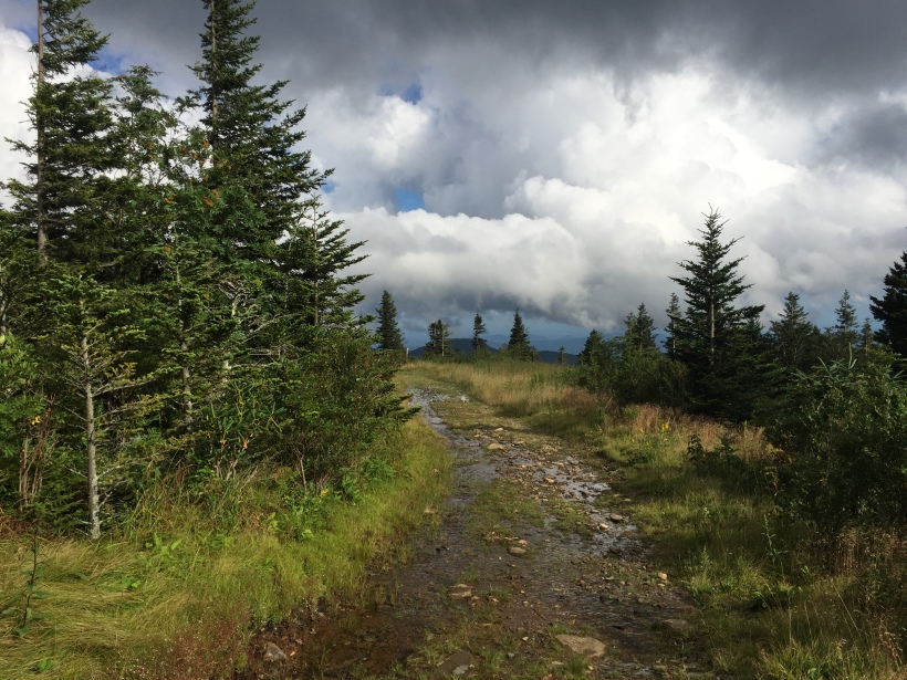
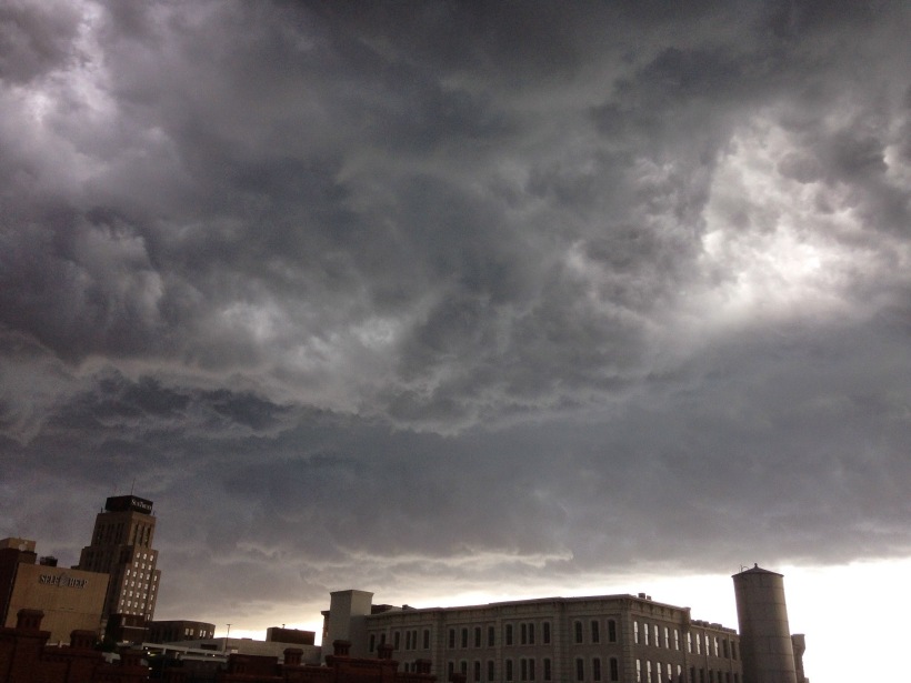
This past week I had a chance to combine two of my favorite pastimes—cycling and photography—in a four-day trip to the mountains of Boone, NC. I’ve lived in central North Carolina since 1993 and have enjoyed my share of trips to the beach and Outer Banks, but had been pretty much ignoring the western part of the state. Shortly after arriving and discovering landscapes like the one below, I wondered what I’d been thinking all this time.

L1000065

In his mesmerizing journals, retired pro cyclist Bob Roll describes how in the late ’90’s Lance Armstrong invited him to Boone for a 10 day training camp building up to Lance’s first Tour de France after his recovery from cancer.  Armstrong had discovered this area during the Tour DuPont, which he won in 1995 and 96.  For Lance the mountain roads of Watauga county were ideal preparation for the Tour.  For me, as a cyclist, they were a chance to dispel my fears about biking uphill.  The Raleigh/ Durham/ Chapel Hill area has plenty of rolling terrain, but not many climbs over a mile or so long.  In the mountains a climb can easily stretch for 5+ miles.  If I could ride in Boone, it would give me a big confidence boost and inspire me to take my riding to the next level.

On my first day I decided to try a 45 mile loop featuring some classic stretches of roads covered by the Tour DuPont.   I could go 45 miles back home without much trouble, L1000020but this route had 5,000 feet of climbing—nearly twice as much as I had ever done even on my longest rides back home—so I was worried that 45 might be too much.  I started from Linville, which meant a few relatively low-key miles before Newland and the first test of the day, a 4-mile, 1,100 ft ascent up a road called Hickory Nut Gap between Newland and Banner Elk.  As I started twisting and turning up the mountainside, though, my trepidation began to disappear as I realized I was putting some distance behind me, feeling pretty strong, and actually enjoying the climb.  I liked it even more after I crested the peak and began a breathtaking 3-mile descent down the back stretch of Hickory Nut Gap.

L1000030But when I made the turn into Banner Elk, my elation was dampened by the huge specter of Beech Mountain looming above. I hadn’t planned to try it on this ride because it would add more miles and intense climbing to an already ambitious route.  Should I go for it and risk not having anything left for the rest of the day?  I spent a minute or two doing some mental calculus that ended with my turning off course and heading up the Beech Mountain Parkway.

According to blueridgecycling.org Beech Mountain’s main section is 3.5 miles long with an average grade of 9.5%, good enough for it to earn it a Category 1 rating in the Tour DuPont.  How steep is a 9.5% grade? Well, all I can say is that on parts of the climb I had a hard time keeping my front wheel from lifting off the ground and doing little inadvertent wheelies.  I chugged away at a slow, steady pace, but by the time I got a third of the way up or so, I realized I was gonna have to resort to my third chain ring (yes, it’s called a “granny gear”), something I had been hoping to avoid, or at least postpone as long as humanly possible.  The third chain ring meant I would be spinning my legs faster but going slower—a trade-off I was ready to make, though, if it meant reaching the top without stopping.  About a half mile from the summit I passed a sign that said “Go Lance” painted on the road.  I didn’t feel much like Lance, chugging away in my granny gear, but a few switchbacks later after I crested the summit and rode into eastern America’s highest town, I felt pretty happy to have made it.  It was strangely quiet there—I guess by late November the tourists looking to enjoy the fall mountain colors have already left, and the winter ski crowds have yet to arrive.  I soaked in the views a little bit before heading back down the mountain.   It took me all of about 6 minutes to make it to the bottom the same way I had come up!  I don’t think I’d ever gone that fast on a bike before.

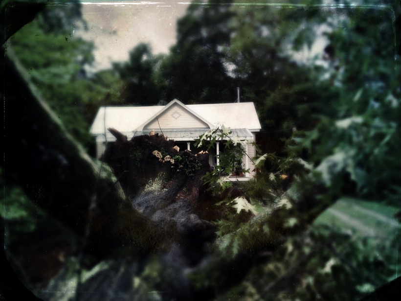
The next part of my route took me toward Valle Crucis along the Highway 194, aptly named the Balm Highway, where I took the photo at the top along with the one at left of what looks like an abandoned store.  L1000057I was glad to be headed northeast and not in the opposite direction, because it was quite a descent into Valle Crucis.  From Valle Crucis there was supposed to be a short jaunt on Highway 105 tying into Shulls Mill, a well-known scenic road heading up to Highway 221 and the Blue Ridge Parkway.  I can sometimes be pretty bone-headed with basic directions, especially when I am tired (I once became disoriented after doing a few somersaults in a pool and tried to swim down in order to reach the surface).  I was true to form here, turning left instead of right on Highway 105, one of the busiest roads in the area, and going all the way into Boone, up a 3 mile climb and adding 10 unanticipated miles to my route after backtracking.  Where is Shulls Mill?  I kept asking myself as trucks belching black soot passed me.  Surely it has to be the next one?  Maybe it’s time to invest in a bike GPS, or at least a cycle computer that will show me how far I’ve gone when my own navigational faculties let me down.  Once I finally found Shulls Mill, I was rewarded with a beautiful but unrelenting 4.5 mile climb, twisting and turning along the Watauga River up toward Blowing Rock.  When I thought I was near the top I passed two kids about 12 or so in orange vests  picking up litter along the road.  I was impressed with their civic-mindedness—they were unsupervised and apparently doing this of their own volition!  As I passed I asked them how close I was to the Parkway.  “Oh, about a mile,” one said after pondering a moment.  “No…about a mile and a half.”  Dang.

L1000100For those of you who aren’t familiar with the Blue Ridge Parkway, it’s a 469 mile-long stretch of road travelling through Virginia and North Carolina, impeccably maintained by the National Park Service.  It was begun by Roosevelt as a public works project and was originally called the “Appalachian Scenic Highway.”  The Parkway is virtually uninterrupted, nice and wide, and the speed limit is 35, all of which make it ideal for cycling.  When I finally reached it, what struck me most was the feeling of the landscape opening up.  The Parkway is high enough that it gets you above the dense forests on the sides of the mountains, revealing the amazing Blue Ridge vistas you hear about and see in postcards.  Having earned the right to take in those views through the long ascent up Shulls Mill made them even more rewarding when I saw them for the first time in person.

What I hadn’t done the day before when I mapped out my route was note that after a few flat miles near Julian Price Lake, the Parkway climbs Grandfather Mountain, a 5,946-foot monstrosity visible from half of Watauga County and looming above almost the entire stretch of the Parkway on which I was travelling.  The main part of this climb is about 1,700 feet over 4.5 miles, and it was really exacting a toll after all the uphill riding I had done.  To make it to the top, I had to wolf down all the remaining energy bars and gels I had brought with me, and needed to break out the granny gear again, which I hadn’t used since Beech Mountain.  Needless to say, I was relieved when I finally saw the sign for Highway 221, which meant an exhilarating descent of three miles back down to Linville where I finally could close out my loop.

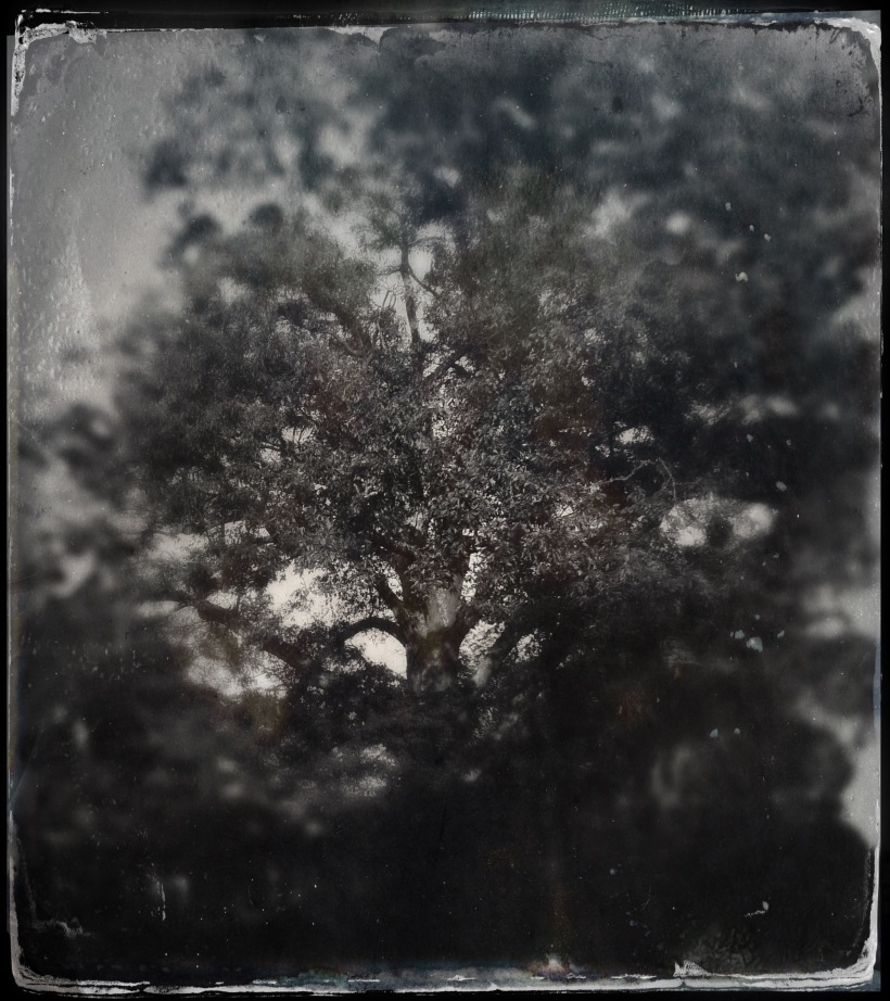
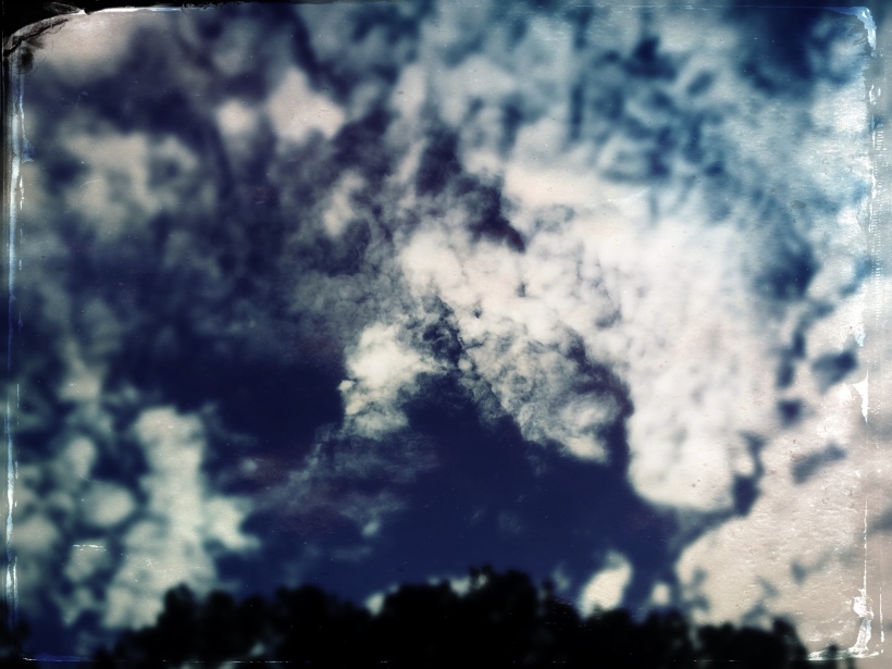
Since I had achieved some of the biggest goals I had set for myself for the trip—proving to myself that I could ride in the mountains, climbing Beech Mountain, doing a long mountain ride—I decided to rest the next day and take lots of pictures, the other passion I had come to the mountains to indulge.   It rained the whole day, and all of the next, so I ended up with lots of dark, moody shots.  I retraced some of my steps from the previous day, and spent some time in Valle Crucis checking out the Mast General Store and taking some pictures in the fields behind it.

I was all fired up the next day to ride again, and had mapped out a 55 mile ride that would introduce me to Highway 221, another one of the roads immortalized by Lance Armstrong and Bob Roll.  221 travels next to and slightly below the Parkway as it winds along Grandfather Mountain.  I planned to ride 18 miles up 221, loop back onto the Parkway following the same section I had bonked on before, and continue south on the Parkway on its long descent to Linville Falls.  From there I would come back up to Linville to end the ride.  My main goals for the day were to pick up my overall tempo and to redeem myself on Grandfather Mountain.  It drizzled the whole day and was so foggy I could barely see where I was going, but I was making good time and felt really good—right up until the 30 mile mark or so.  Nearing the top of Grandfather Mountain, I began to feel a distressing sharp pain in my right knee at the bottom of my pedal stroke.  I had just gottent a new cleat/ pedal system and obviously have a few kinks to work out in terms of positioning.   L1000666Some more quick mental calculus, and I decided I needed to head back to Linville instead of continuing on to the falls which would have meant coming 12 miles back uphill.  Wet and full of mud, I arrived back to my cabin a little disappointed that mother nature had effectively called an end to the cycling portion of my vacation, but overall very happy with how things turned out on my trip.  I spent the rest of my last day taking pictures on the foggy Parkway and doing touristy things.  But in the back of my mind I was already plotting ways to make it back to Boone for more cycling.  Would it be possible for me to drive out in the morning, ride, and return the same day?  Maybe drive in late one afternoon, stay overnight, ride, then come back later the next day?  I feel lucky that there seem to be plenty of options.  After all, it’s only a three-and-a-half hour drive from Durham to the heart of the NC High Country.

45 of my favorite photos for the trip are available on Flickr:  http://www.flickr.com/photos/toddstabley/sets/72157622759451565/
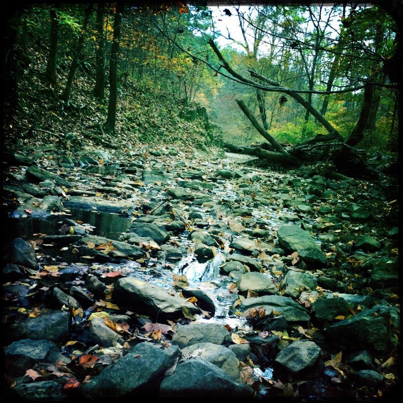
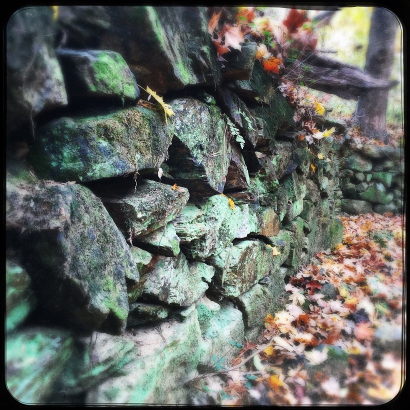
L1000383

Back into cycling after 25+ years

Last night I cleaned my chain, finished up my cue sheet, and dotted my i’s, and crossed my t’s for what would have been my biggest ride so far this year of 90 miles.  I’ve been planning a loop around Hillsborough, NC based on this year’s Bikefest 100-mile route.  When I rode that event this August I was pretty out of shape, having just bought my new GT Transeo 1.0 hybrid the month before and used it mostly to commute a total of 6 miles per day.  There are a few hills on the way to work, and I thought I was doing OK on them.  Plus, when I was a teenager in the early 80’s I rode some long distances with my dad (even a hundred miles once or twice) on the relatively flat terrain around the Detroit area.  But in retrospect I wasn’t prepared for the 62 miles of rolling Hillsborough countryside I signed up for.

I finished, but it wasn’t pretty–it took me nearly 6 hours and a lot of lingering at the rest stops to make it through.  The real humiliation, though, was getting passed by all sorts of people I didn’t think should be passing me.  Young, old, big, little–let’s just say I resolved to get myself into much better shape after that experience!

Using bikely.com I planned some really cool routes over the past few months through some of the most scenic parts of Durham, Chapel Hill/Carrboro, and Hillsborough, working my way up in about 10 mile increments from 20 to the 72 I did last Sunday through Saxapahaw.

The last one was a great ride.  I discovered Saxapahaw, a cool  town on the Haw River where, they say, lots of hippies live (to me, that’s a good thing), and whose General Store, I hear, serves a mean seafood gumbo.  Traffic on the back roads was light and pretty courteous, with the notable exception of a white monster truck that belched big black clouds of soot into the air and whipped by me with just a couple feet to spare in the middle of the ride.  Best of all I started to feel like I’m getting strong on the bike.  The way I’ve been measuring this is by seeing how long I can keep up with the serious-looking guys who try to pass me on their carbon road bikes near Dairyland Rd. in Chapel Hill, a major destination in the area for cyclists.  A couple of months ago I didn’t have a chance, but on Sunday I think I surprised a couple guys by staying on their tail, in one case for a 3 mile stretch before our routes diverged.  I’m looking forward to the day when I can pass them back again on my hybrid!

The only downer on this ride was when I got passed by a pickup truck with a young black lab in the truck’s bed.  His owner had secured him to the bed of the truck somehow by his leash, and believe it or not the dog tried to jump out of the truck after me.   The poor thing got dragged a good bit by the neck until his owner was able to stop.  It was really frightening to watch, but I stayed there with the owner for a bit and believe the dog is actually OK except for a medium case of road rash on his poor paws.  Geez, man–use some common sense next time and put your dog in the cab.

It’s nasty weather today, and I’m officially rained out.  But next weekend, look out Hillsborough–I’m about to get some revenge for the thrashing you administered to me this August.  If I can do 90, I know it will be just a hop, skip, and a jump to a century–something I didn’t think myself capable of just a few months ago.